
The Best Hiking Trails in Los Angeles, CA
Explore Hiking TrailsTrail adventures from Santa Monica to San Clemente
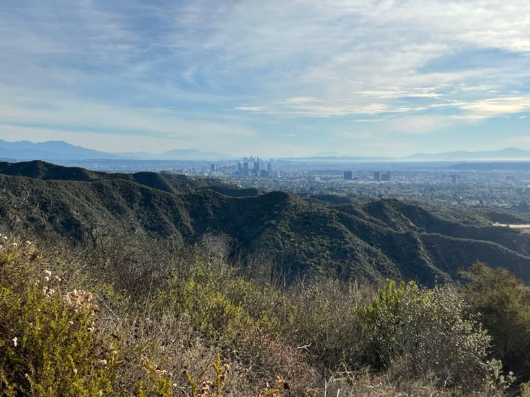
Los Angeles is a great city for hikers of all skill levels. But what are the best hikes in LA? With the Angeles National Forest to the north and The Santa Monica Mountains to the northwest, there are so many great hiking trails and trail networks to explore.
If you’re looking for a classic LA hike adventure, you can’t go wrong with the Hollywood Sign Hike. For an easier hike for the whole family, consider the Griffith Observatory which has great views of the city. You can’t go wrong with any of these great hikes.
At Strava we use data from millions of hikes to make sure you have the most accurate and most up to date information before you head out on the trail.
Top 10 hiking trails in Los Angeles, CA
1


Los Leones Canyon Trail
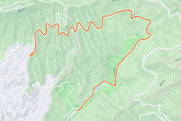
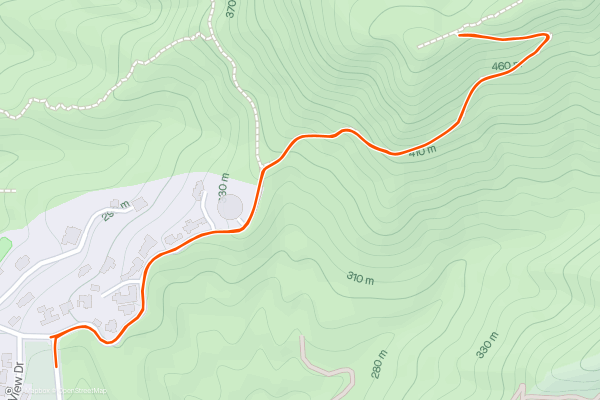
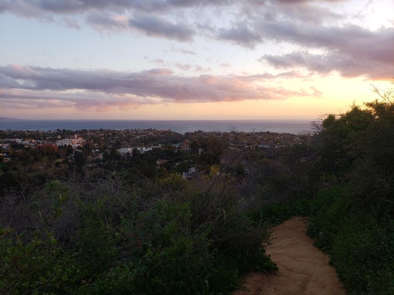
The Los Loenes Canyon Trail is a fun hike with spectacular views of the Pacific Ocean, Santa Monica, and the Pacific Palisades. On a clear day, you might even be able to see Catalina Island shimmering in the distance. This hike follows an out and back route. The hike is on the shorter side, but steep sections near the end ensure you’ll get a good workout. This is one of the most popular hikes with Strava members in the Los Angeles area.
2


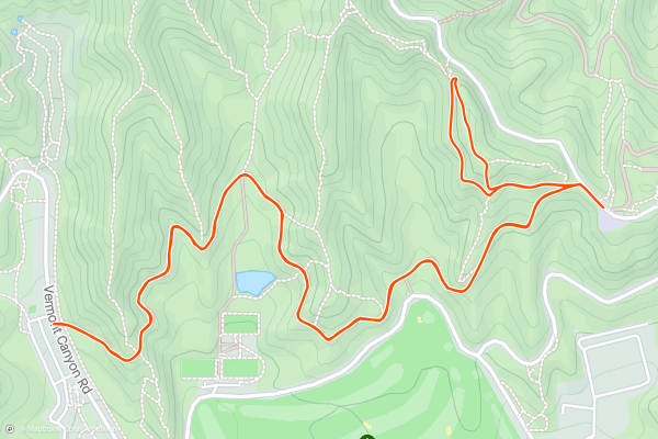
Glendale Peak via Riverside Trail and Hogback Trail
Glendale Peak via Riverside Trail and Hogback trail is a great hike with interesting trailside landmarks in Griffith Park. On your way to the summit’s panoramic views, you’ll pass a memorial to a prominent Sierra Club member as well as a stone staircase etched into the mountainside. This trail follows an out and back route with a loop section at the end. Because of the steep grades towards the end, most consider this a moderate trail. There are many hiking options in Griffith Park. This combination of trails is the most popular among local Strava members.
3


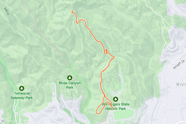
Backbone Trail to The Bridge
This hike in Will Rogers State Park takes you along the famous Backbone trail to a man made bridge with great views of the Santa Monica Mountains. The Backbone Trail is 68 miles long and covers the entire Santa Monica Mountain Range. This hike follows an out and back route along the first few miles of that trail. Most consider this a moderate hike. There are many hiking trails in Will Rogers State Park, but this is the most popular route with Strava members.
4


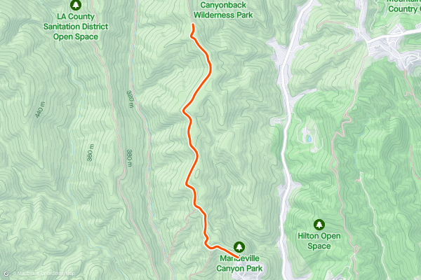
Mandeville Canyon Trail
This popular hiking trail follows the West Mandeville Canyon Fire Road to great views of the Westridge Canyonback Wilderness Park. The trail follows an out and back route. Most consider this a moderate hike. The Mandeville Canyon Trail is one of the most popular hikes in the Los Angeles area.
5


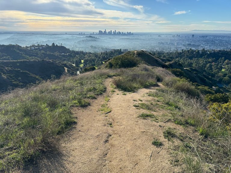
Griffith Observatory
The East Observatory Trail is a fun and welcoming hike to the Griffith Observatory and amazing views of LA. This trail follows an out and back route. At the summit you’ll be able to explore the iconic 1935 building before making your way back down. This is a moderate trail, but may be suitable for adventurous younger hikers as well. No list of hikes in LA could be complete without a trip to the Griffith Observatory. This is a popular hike with locals and visitors alike.
6


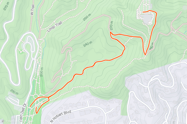
Fryman Canyon Trail
The Fryman Canyon Trail is a fun loop trail that begins and ends in Wilacre Park. You’ll climb through classic LA landscapes and spend some much needed time away from the hustle and bustle of the city. Most consider this a moderate hike. This is a popular hike with Strava members local to the LA area.
7


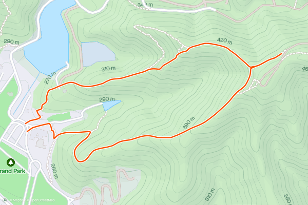
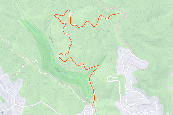
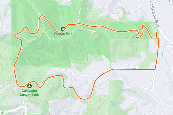
Brand Park Loop
This loop in Brand Park is a short and steep hike often completed by Strava members. You’ll traverse the perimeter of one of the park’s canyons and take in great views of Glendale, Burbank, and Downtown LA. The hike is on the shorter side but has consistently steep grades throughout. This loop is guaranteed to give you a good workout and may not be suitable for beginner hikers or young children. At the top of the loop, Strava members often take a short detour to a viewpoint just a little further up the trail.
8


Hollywood Sign View Hike
This popular hike uses the Bush Canyon Trail and the Mulholland Trail to access one of the best views of the Hollywood Sign. The Trail begins by taking hikers through Bronson Canyon. You’ll then navigate a series of steep switchbacks before reaching Mt. Lee Drive. A short trip down this public street will take you to fantastic views of the iconic Hollywood Sign. The trail follows an out and back route and is guaranteed to give you a challenging workout. This is one of the most popular hikes in the area for local strava members and visitors alike. No time in LA can be complete without seeing the Hollywood Sign up close!
9


Wisdom Tree via Burbank Peak Trail
Take the Burbank Peak Trail to the Wisdom Tree, a beautiful tree with great views of LA and the Hollywood Hills. This trail follows an out and back route. The trail isn’t particularly long, but because of the steep grades while approaching the summit, most consider this a hard hike. This hike is popular with local Strava members and the views from the top are well worth the effort.
10


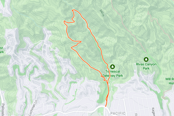
Temescal Canyon Trail
The Temescal Canyon Trail is a great hike featuring a waterfall and spectacular views along the way. This hike follows a loop route through Temescal Gateway Park. Most hikers choose to complete the route in the counterclockwise direction. Because of the length and steep average grades near the falls and viewpoints, most consider this a hard hike. This trail is popular with local Strava members.
Top regions for hiking trails on Strava
- Austin, TX
- Boulder, CO
- Great Smoky Mountains National Park, TN
- Las Vegas, NV
- Los Angeles, CA
- Maui, HI
- Mt. Rainier National Park, WA
- New Hampshire
- New York, NY
- Phoenix, AZ
- Portland, OR
- Salt Lake City, UT
- San Diego, CA
- San Francisco, CA
- Santa Fe, NM
- Seattle, WA
- Sedona, AZ
- South Lake Tahoe, CA
- Yosemite National Park, CA
- Zion National Park, UT